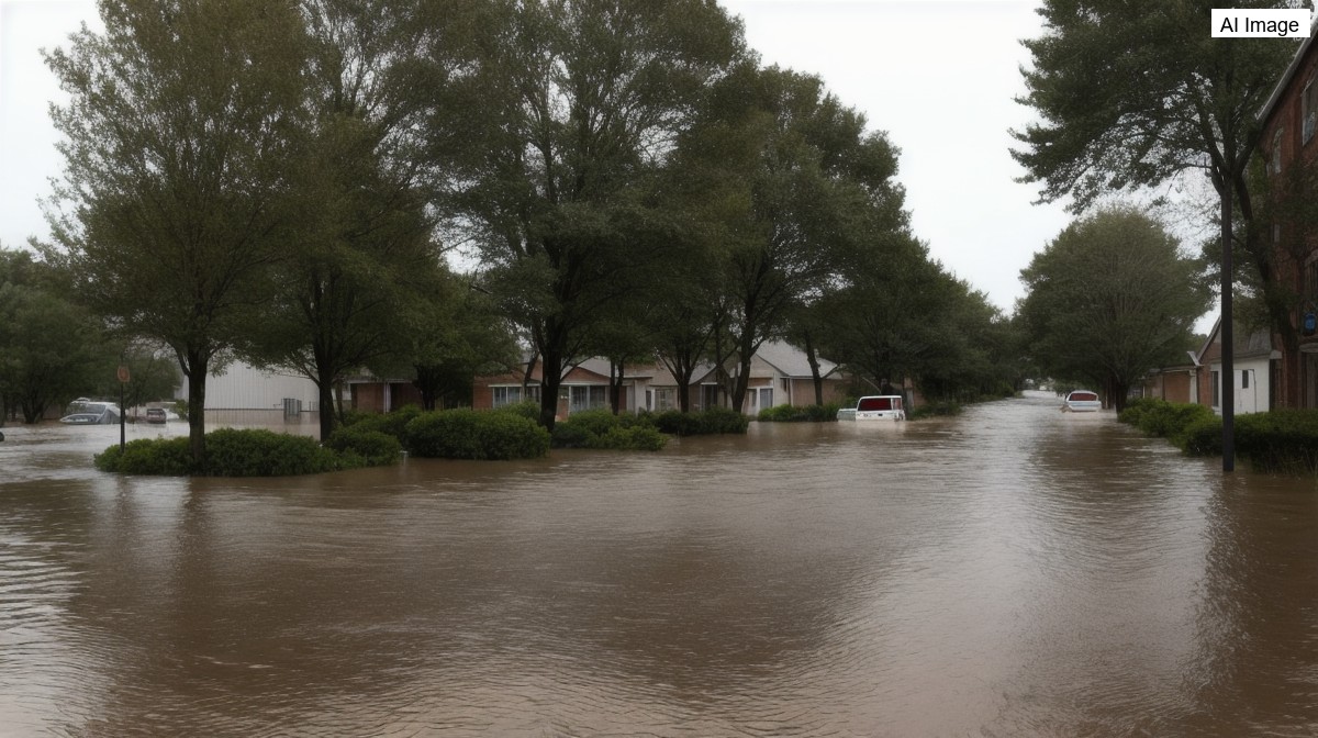
A slow-moving line of heavy rain stalled over the Houston area on Tuesday, dumping torrential amounts of water on Montgomery County and northern Harris County and prompting a series of flash flood warnings. The band of storms set up and then refused to move, with forecasters describing a stationary line stuck roughly between Spring and Conroe that kept hammering the same communities for hour after hour. The result was rapidly rising water across an area that had woken up dry only a short time earlier.
The rainfall rates were extreme. Near the Woodlands High School, in the Cochran's Crossing community along Research Forest Drive, around three and a half inches of rain fell in a single hour, with the sky opening up to drop close to half an inch in just five minutes at one point. Forecasters said the totals were piling up because the cluster of rain was barely creeping southward, leaving the same neighborhoods under the heaviest downpours for an extended stretch.
Flash flood warnings were issued for the hardest-hit areas, including one covering Conroe that ran until noon and a notably long warning for the Woodlands, Shenandoah, Spring and Tomball that was set to remain in effect until 1:30 p.m. Officials stressed that a flash flood warning means flooding is already occurring and is generally considered life threatening because of fast-rising water, noting that most flood deaths happen in vehicles and urging residents to stay home rather than venture out.
The flooding quickly reached the roads. Feeder lanes along Interstate 45 took on water, with the stretch around State Highway 242 left covered enough that drivers stopped, some backing up while others tried to push through. Live traffic cameras showed only the left lane offering any chance of getting past, and even then mostly larger vehicles and SUVs were attempting it, while sedans sat at a standstill rather than risk the high water. Despite the deluge, forecasters noted there was no severe weather in the sense of tornadoes, damaging winds or hail.
As the morning wore on the threat spread westward. The National Weather Service issued a fresh flash flood warning, in effect until 1:15 p.m., covering Harris County, southwestern Montgomery County and northeastern Waller County, taking in the Highway 290 corridor out toward Hockley and Waller. Doppler radar indicated that between two and a half and three and a half inches of rain had already fallen there, with rates of three to five inches an hour and the potential for another two to four inches, pushing possible grand totals to around four and a half and in places up to six inches. Forecasters said flash flooding was ongoing or expected to begin shortly and urged residents around the Woodlands, anywhere north of Spring, and in the Waller area to stay home and off the roadways, singling out Tomball, the Woodlands and the northern parts of Spring as the greatest areas of concern.
Adding to the concern, the National Hurricane Center issued a forecast for what it labeled Potential Tropical Cyclone One, a developing system spinning near the South Texas coast around Corpus Christi. Forecasters said the system, which could become Tropical Depression One or, if it strengthens enough, Tropical Storm Arthur, was expected to track along or just off the coastline with maximum winds near 40 miles per hour. They described it as primarily a rainmaker rather than a major wind threat, with much of the heaviest rain likely to head toward Louisiana.
On the strength of that system, a Tropical Storm Watch was issued for the coast, meaning tropical storm conditions were possible within the next day and a half. Forecasters cautioned that the watch could be upgraded to a warning if the system organizes into a named storm, and warned of more heavy rain along the coast on Wednesday. For now, the immediate danger remained the stalled flooding inland, with officials repeating their advice to avoid the flooded roadways and wait out the worst of it indoors.
By late morning the system driving the rain had taken a more defined shape. The National Hurricane Center designated it Potential Tropical Cyclone One at around 11 a.m. and said it was likely to strengthen into Tropical Storm Arthur within a day or so, riding along the southeast Texas coastline and edging toward southwest Louisiana before dissipating farther inland late Wednesday into Thursday near the Mississippi and Louisiana state line. More than 17 million people across the region were placed under a flood watch as the heavy rain stretched from South Texas toward the Florida Panhandle.
The wider storm had also turned deadly. Officials said a woman was killed near San Antonio when her car was washed away by the floodwaters, a stark illustration of the warning that most flood deaths happen in vehicles. Elsewhere across the state, drivers in Waco and in Houston were left stranded in water that reached the tops of their tires, and heavy rain was forecast to continue across the flooded region through Wednesday.